

Coconuts for Kuna Yala

It's 2am. Getting up for a drink of water, I realize I can see stars, even before I put my glasses on. It had been a cloudy sunset, so starlight was unexpected. I’d closed hatches, counting on early morning rain instead.
Quietly, I open the companionway and climb out into the dark cockpit and count 8 anchor lights atop the other masts of sailboats here with us.
There is a warm breeze blowing in from the ocean and I can hear the steady white noise of nearby waves, but Miette is almost completely motionless beneath my feet, seemingly asleep save for her wind generator whispering astern.
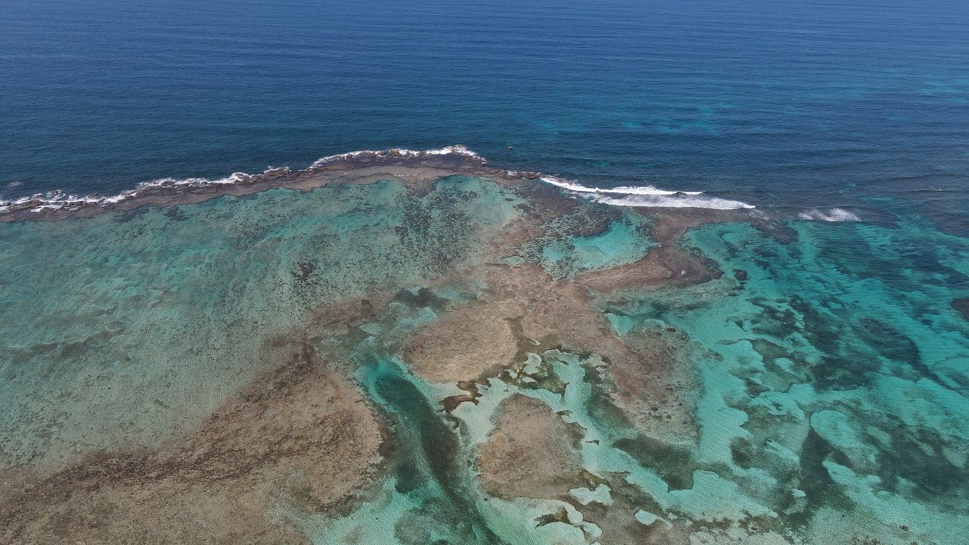
We are anchored in water only 10 ft deep among a chain of small islands protected by a reef 7 miles long. The area is named the East Holandés Cays, or more properly, the Maqui islands, as they’re known to the indigenous Guna people. The sea breaks against the reef near us, but behind it, only tiny wavelets lap softly against our hull. I can’t see it at night, but during the day we can watch the sea crashing white and furious against the reef.
Shawn somehow senses I’m not in bed, slides open the companionway to wonder what I’m doing. I’m not doing anything besides enjoying the night, cooling off while my mind is as empty as the midnight breeze. She comes out and sits near me in silence, both of us simply existing in the deep tranquility of where we are.
It took us 4 day-passages to cover 60 miles of easterly sailing to get here. We had originally planned to go west, with the seas and winds comfortably behind us, but we saw a break in the weather that would let us get to the San Blas islands of Kuna Yala, an autonomous region within Panamá ruled by the Guna.
Our first day was rough, and I was second guessing my decision to head east less than an hour after leaving the comfort of Shelter Bay.
We approached the gap in the breakwater where we'd pass from a bay out into the open sea. The radio tuned to VHF channel 12, we listened for ship traffic. Panamax-sized ships would be entering and leaving the Panama canal throughout the morning, large enough that only one ship can pass through the channel between breakwaters.
A massive car carrier coming out of the canal looked almost stationary at first, but quickly built up speed. Our navigation computer picked up their signal and calculated their trajectory against ours, showing we'd be run down right in the channel, so we slowed and let them pass.
When they channel looked clear, I radioed "Cristobal Station, this is sailing vessel Miette, leaving Shelter Bay for Portobelo."
"Proceed."
We pitched forward and then back, rising and falling over the waves. In the trough between waves, I stood at the helm eye-level to the next waves. So much for the forecast of 3 ft seas.
Maybe the seas are just disturbed by the breakwater, I thought. No, they only got worse. Over the next hour, we averaged less than walking speed. The wind picked up, against us. In the colorless overcast, the sea water looked black with white caps.
It began to rain. I changed into swimming shorts and put on a raincoat, standing barefoot at the helm. Shawn braced herself in the cockpit against the motion, as there wasn't much else to do but ride this out.
Every hour brought a new change in conditions, sometimes a little better, sometimes worse, but never pleasant.
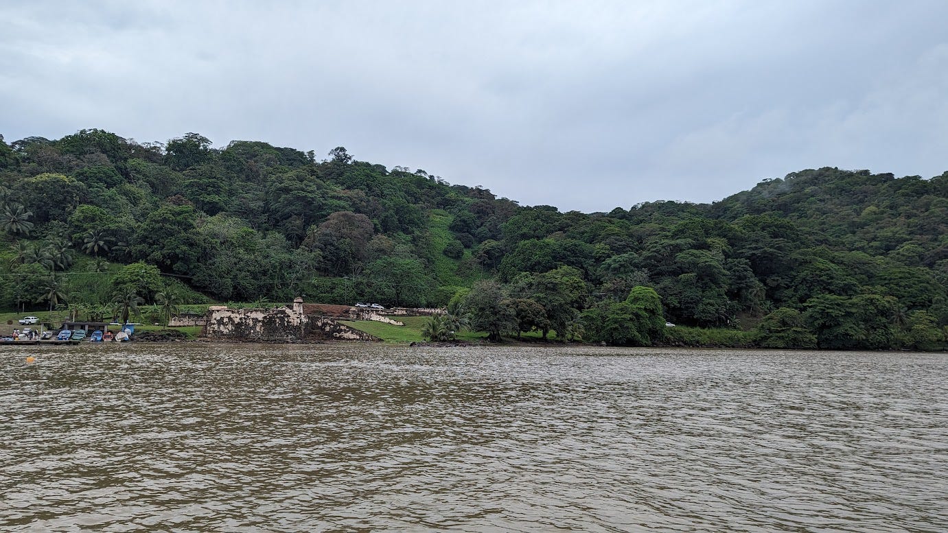
By mid afternoon, we reached the bay of Portobelo. Only a few thousand people live there now, but once this had been a Spanish stronghold, originally discovered by Cristobal Colón, or as we know him, “Columbus”. The heavy rains had made the water murky with silt, Miette cutting through it and leaving a trail of clearer water behind her.
We dropped anchor between a couple cruising sailboats like us and a couple derelicts that appeared to have sat for decades. A couple people had recommended that we enjoy exploring Portobelo, but we rested and enjoyed sleeping comfortably in the protected bay for only one night. Miette sat calmly at anchor, overlooked by rusting Spanish cannons in an old fortification. I promised Shawn that when we head back this way, we'll take our time.
The seas were slightly better on our second day, just a short passage under 4 hours to exit the bay and press further east, taking refuge behind a small island, ironically named Isla Grande. Big Island. You could walk across it in half an hour. Two derelicts are in the anchorage, including one catamaran which has one sunken hull.
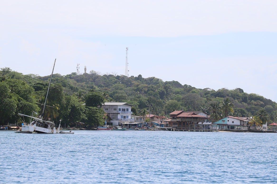
The anchor dropped into clear, baby blue water just before noon, the sun out now in full force. We jumped in the water to cool off and I even got my pool noodle to float around next to Shawn for a little while. She enjoys the water, where I'm only there tolerating it, trying to make the best of it, but really resisting the urge to get back out of the water as soon as possible. It makes her happy when I swim around with her for even a few minutes so I oblige.
I dried off, set up my hammock in the shade of the cockpit and took in the surroundings while Shawn swam to a nearby reef. Small skiffs would pass by frequently, taking tourists to and from the island and through a cut in the reef. Two of the boats stopped near Shawn, telling her she should have a float so they could see her, so she swam back to the boat.
“The bottom is all sea grass, anyway.”
From what we could see, the island had a small hotel and a couple restaurants. Perhaps we'll stop and go ashore some other time.
We set an alarm for 5am the next day, as a long stretch of coastline lay ahead of us, and we need to arrive in daylight. After coffee, breakfast, and an engine check, were on our way under a low, ominous overcast. The sun had come up, somewhere, hidden behind thick clouds.
Rocks near the island forced us to pass near the shore, through big swells rolling in from the open sea. We didn't talk. I hand-steered the boat, tracking our progress carefully, ready to turn us around and take the long way around the island if necessary.
Once through the channel and away from the island into the ocean, the waves returned to normal.
We moved steadily through black water as it began to sprinkle. And then rain. And then a downpour so hard the black sea erupted in tiny white explosions where bullets of rain fired down. I’m tempted to get a camera, but I’ve already lost one GoPro, supposedly water-proof, to conditions like this. Speaking to each other would have been impossible without yelling, the roar from the deluge against the solar panels above us was deafening.
An hour later, blue skies, calm seas. An hour after that, rough seas and headwinds, slowing us down.
The islands of San Blas are nestled among hidden reefs, rocks, and shallows, so the prudent mariner only approaches during the day and with good light. Our navigation computer's estimated time of arrival went from 3pm to 4, and as the seas got worse, started bouncing between 8 and 10pm.
Plan B was a small, shallow bay, Bahía Escríbanos. Our cruising guide said it can only be entered by boats drawing less than 4.5 feet of water. Miette draws 4 ft, 4 inches, so I changed course for the bay.
The approach into the bay required carefully going around and between underwater reefs, some visible by the waves breaking on them, some just dark shapes in the water. I slowed Miette down to a crawl, with just enough water over her rudder to have good control. If we hit something, I didn't want to hit it hard or fast.
Passing through the gap in the reefs, the water became flat. We could see the shallow entrance ahead, and wearing her lifejacket, Shawn stood at the bow looking forward.
"I think it's really shallow ahead!" She called back. I looked down at the sonar in time to see it read a depth of -1.5 ft, and feel the keel slide through mud.
In a split second I had the rudder hard to starboard and put in full power to turn us around into deeper water. Shit! We've been stuck aground in mud before, but that was in Pacific where we could count on tides to refloat us. The tides in this sea are in inches!
Visions of the hard labor of putting out spare anchors, taking back-breaking turns at a winch to kedge ourselves out of the mud and into deeper water flashed through my head, or of paying a local to try pulling us out with a fishing boat, should one come by.
Fortunately, we never completely lost momentum. Miette responded, turning sharply to starboard, powering through another bank of mud, and then accelerating once we were in deeper water. I aimed the bow back out to sea, heart racing.
We were okay. I followed our track back out of the bay. Once clear of the reefs, I lowered the RPMs to let the engine cool down, and did some deep breathing, grateful that this hadn't turned into a nightmarish ordeal. I pat the binnacle, where the instruments are mounted, and feel no embarrassment to talk aloud to her.
“Thank you Miette, sorry about that.”
The sea was strangely calm, the sky clear, and the winds were now gently blowing behind us. Where was this good weather an hour ago when I felt like getting the hell off the ocean?
The navigation computer showed a steady 6pm arrival. That was still too late, the sun too low for a safe, visual approach through reefs into the island anchorage I had in mind.
I panned around the nautical charts to examine one area that I'd noticed during my trip planning. Absolutely nothing was said about this spot in the Navionics navigation app or the cruising guide, but when looking at the chart , the regarded cartographer Eric Bauhaus had placed not one, but three anchor symbols behind this reef, with a thin red zig-zag line, waypoint to waypoint, showing a safe passage.
At the entrance to the bay where the San Blas islands lay, there is a big reef. A narrow channel in between reefs allows a small boat to enter, pass behind the reefs, and dodging a couple coral heads, drop anchor in a big patch of sand.
I changed our destination in the navigation system to this spot, manually adding waypoints to weave through the reef, and it showed an estimated arrival time of 3:30pm.
Perfect. We'd have good light to see obstacles and find the sandy patch.
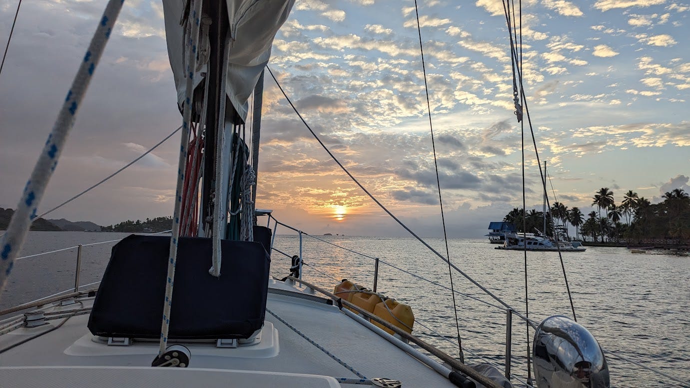
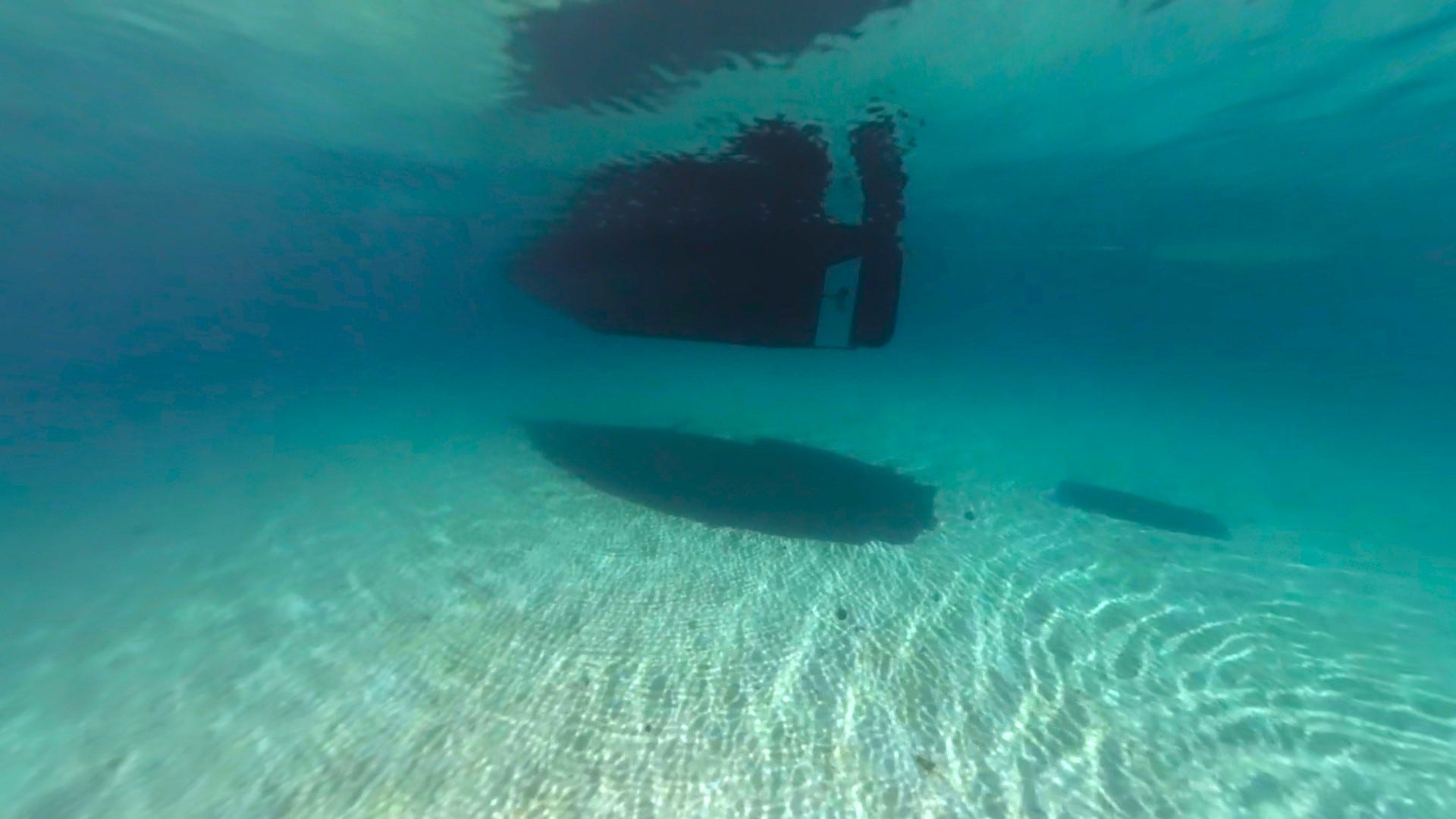
Again, I slowed us as much as possible without sacrificing steerage, and we threaded our way carefully through the reef, found the sandy spot behind it in 10 feet of flat, clear water. We dropped anchor and breathed sighs of relief, watching an ulu, a canoe with a makeshift sail, float by.
We awoke refreshed the next day, with only 15 miles to go. Small white cotton balls dotted the blue sky, and winds from behind us.
I chose the easternmost island as our destination. Since we plan to head west, reaching western Panama by July, I'm hoping we can use the easterly trade winds to hop around various islands before we sail back the way we came, spending more time in places we passed up.
Taking it slow, we went around more reefs into “the swimming pool” anchorage and drop anchor, back down to dig it in, then float around. The wind lazily shifts around and a few hours later, our bow is right on top of the anchor, plainly visible through the perfectly clear water, the plow buried completely in the white sand.

It's approaching the rainy season, so all bets are off on which way the winds blow in the coming months as storms disrupt the normal easterly tradewinds. Should we see a lot of westerly winds, heading east to Cartagena Colombia is an option, too. For now, there’s no hurry to go anywhere.
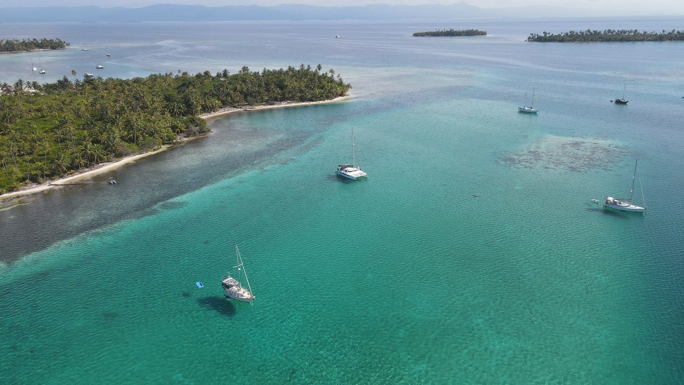
We've spent the week anchored in 10 ft of warm, clear water, and from the boat, we can clearly see conch, sand dollars, and sea stars crawling along the bottom.
Schools of little fish have moved into Miette’s shadow, and I’ve seen eagle rays several feet in diameter float by. Shawn says I’ve only seen the little ones. She spends much more time in the water. I’ve yet to catch one on camera, but occasionally these large animals leap out of the water to belly-flop with a great splash.
Yesterday, a pair of small sharks, maybe 4 or 5 ft long, swam around us for a moment. Perhaps we should be grateful to sharks for having driven our primordial ancestors to look for a means of survival on land - but I certainly don't feel any compulsion to be in the water with them. Maybe I'll change my mind. A sailing couple stopped by in their dinghy to say hello, and a shark happened to swim by in front of us as we talked. I’d been just about to jump in the water, and said so.
“Oh, these kinds of sharks almost never bite anyone!” said the woman.
Almost never?
Even without sharks, it is a feat of will for me to get in the water, but the visibility goes a long way in helping my willingness. Maybe I drowned in a past life, but I’m “almost never” comfortable in the sea. Yes, the irony, given my chosen lifestyle, but I do occasionally buck up the courage and get in, and other times I “supervise”. From the boat, we can swim to a coral reef, seeing varieties of coral and fish we hadn't seen in our Pacific journey, as well as familiar ones.
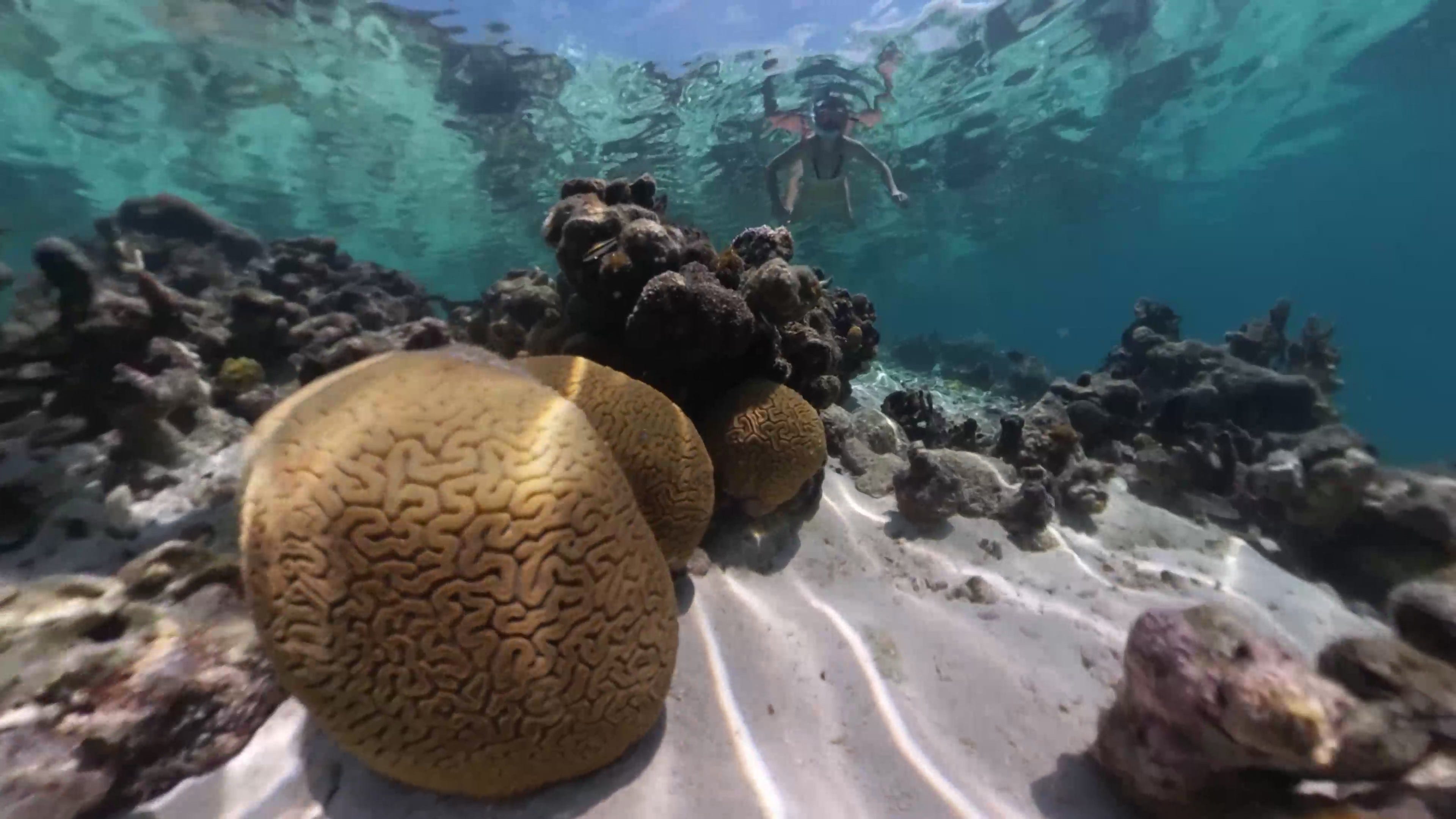
The small islands around us are adorned with lush green plants and coconut trees. Normally we help ourselves to coconuts, but they all belong to the indigenous Guna people who live in small dwellings that dot the islands. These islands in turn are protected by reefs which block the ocean swell.
It is 9pm, also known as sailor’s midnight. Goodnight friends, and thanks for reading.
Please enjoy a 4K video we produced about our time here: